GeoRhena Catalogue
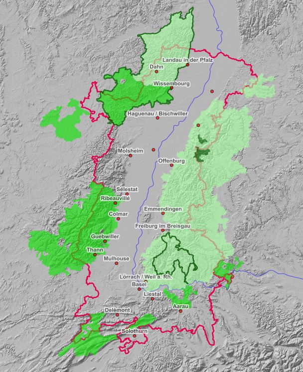
Carte interactive des sites protégés du Rhin Supérieur
Interaktive Karte der Schutzgebiete am Oberrhein
Interactive map of protected areas in the Upper Rhine
Carte interactive intégrant les différentes données à propos des sites naturels protégés sur le territoire du Rhin Supérieur.
Interaktive Karte, die die verschiedenen Daten über die Naturschutzgebiete am Oberrhein zusammenfasst.
Interactive map integrating the different data about the protected nature sites in the Upper Rhine area.
Simple
-
Datumsangaben (Publikation)Date (Publication)Date (Publication)
- 2021-05-11T14:38:13
-
PräsentationsformPresentation formForme de la présentation
-
Digitale KarteDigital mapCarte numérique
-
BearbeitungsstatusStatusEtat
-
AbgeschlossenCompletedFinalisé
- Point of contact
-
Organisation name Individual name Electronic mail address Role GeoRhena
VertriebDistributorDistributeur
-
ThemaThemeThème
-
-
parcs;naturels;biosphère;Naturparks ;parks;Biosphärenreservate ;2021;carte;Interaktive;Karte;interactive
-
-
GEMET - Concepts, version 2.4
-
-
parc national
Nationalpark
national park
-
parc naturel
Naturpark
natural park
-
parc naturel régional
Regionaler Naturpark
regional natural park
-
biosphère
Biosphäre
biosphere
-
réserve de biosphère
Biosphärenreservat
biosphere reserve
-
-
SpracheLanguageLangue de la ressource
- Français
-
ThematikTopic categoryCatégorie ISO
-
-
UmweltEnvironmentEnvironnement
-
))
-
Identifikator des ReferenzsystemsReference system identifierNom du système de référence
- EPSG:3857
- Distribution format
-
Name Version OGC:OWS-C
- OnLine resource
-
Protocol Linkage Name WWW:LINK-1.0-http--link
https://geoportal.georhena.eu/mapstore/#/viewer/openlayers/87 Ouvrir la carte interactive
Die interaktive Karte öffnen
Metadata
-
MetadatensatzidentifikatorFile identifierIdentifiant de la fiche
- 9f70d363-25fe-45a2-8528-89fe2e06eaa4 XML
- Metadata language
-
fre
-
ZeichensatzCharacter setJeu de caractères
-
Utf8UTF8Utf8
-
HierarchieebeneHierarchy levelType de ressource
-
Interactive mapInteractive mapCarte interactive
-
DatumDate stampDate des métadonnées
- 2022-09-26T14:43:52.130747Z
- Metadata standard name
-
ISO 19115:2003/19139
- Metadata standard version
-
1.0
- Metadata author
-
Organisation name Individual name Electronic mail address Role GeoRhena
AutorAuthorAuteur
- Other language
-
Language Character encoding DeutschGermanAllemandUtf8UTF8Utf8EnglischEnglishAnglaisUtf8UTF8Utf8FranzösischFrenchFrançaisUtf8UTF8Utf8
Overviews
Spatial extent
Provided by